
A Guide for Loopy Hikers
In her latest book, Nicola Ross offers aspiring Bruce Trail end-to-enders 40 loop hikes from Niagara to Tobermory.
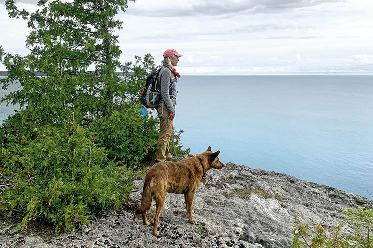
Hiking the Bruce Trail from end to end is on the bucket list of many a devoted hiker. But covering the main trail’s 900 kilometres from Niagara to Tobermory comes with difficult logistics – usually involving backtracking to your entry point each day, or hiking with a companion and dropping a car at either end of the day’s route.
Now Caledon writer and dedicated hiker Nicola Ross has a solution to that problem – covering the entirety of the Bruce Trail in single-day loop hikes by taking advantage of the many side trails that branch along the main trail.
A longtime contributor to this magazine, Nicola is also the author of six Loops & Lattes regional hiking guides. The success of those guides inspired her to adapt the idea of loop hikes to the big canvas of the Bruce Trail.
The result is her new book, 40 Days & 40 Hikes: Loving the Bruce Trail One Loop at a Time. Filled with anecdotes and historical vignettes, the highly readable book is part hiking guide, part memoir and part cri de coeur for the preservation of the magnificent natural landscape all along Niagara Escarpment, recognized as a UNESCO World Biosphere Reserve.
The following is an excerpt from Nicola’s chapter on her “home trail” through Belfountain and the Forks of the Credit.
. . . .
When I set out from Queenston 15 loop hikes ago, my ultimate destination was Tobermory. But my first goal was to get ‘home.’ Today I arrived. I walked on paths embedded in my genes and alongside rivers that course my veins. If I have trouble falling asleep, rather than count sheep, I trace the route of the Credit River and the layout of the local Bruce Trail in my mind’s eye.
I parked at the dead end of Chinguacousy Road, not far from the Cheltenham Badlands, and took off on the main BT as it climbed to “the quarry” through a dense forest. There was scant sun beneath the thick canopy, and I had to watch my footing along the rocky trail. Bedrock surfaces through here, a fact taken advantage of by the owners of a flagstone quarry that has been around longer than the BT. When I was a kid, if the owners caught us riding our horses along the quarry road, they’d accuse us of trespassing and chase us away.
Following this childhood-memory-filled road, I passed by bayou-like swamps and between mosquito-rich ponds. The mud was seriously black, pungent and earthy; it would suck you under if you strayed too close. After passing the quarry entrance, the main BT climbed “the mountain” and entered Caledon’s “Equestrian Neighbourhood.” As I walked along the familiar dirt road, I could feel the rhythmic sway of sitting in a saddle.
. . . .
Turning right onto Creditview Road, the main BT takes advantage of the road allowance to get down to the Forks of the Credit. It’s amazing how much of the trail follows these remnants of public land, and it’s a good thing too. If the BT didn’t follow them, I’m not sure cash-strapped municipalities could resist selling these parcels of land to adjoining landowners who would erect the No Trespassing signs that motivated [BT co-founder Ray] Lowes. Without abandoned railway lines, utility rights-of-way and unopened road allowances, there wouldn’t be a BT.
. . . .
I weaved through rocks as I approached what people refer to as the Devil’s Pulpit – a protuberance in the cliff face that gives rise to this moniker. I looked out over the Credit River valley, a green expanse that stretches as far as I could see … I began my descent via irregularly spaced stone steps that hug the wall of the escarpment. A handy rope that loops from metal rings drilled into the limestone acts as a makeshift railing. By providing a landing from which the stairs descend diagonally down the cliff face, the Devil’s Pulpit was the BT’s final link.
. . . .
Down I went over slippery rocks decorated with maidenhair spleenwort and through towering cedars. How many times have I walked this route? I wondered. I chuckled recalling a photo I took of my mum on this trail. She’s wearing a navy blue sweatshirt. Emblazoned in large white letters across her chest are the words “Sixty and Sexy.” I’m now older than she’d been when I took that shot. How was that possible? I was reassured when I spied a healthy cluster of walking ferns on the rock where I expected to see them. Cold air escaping from deep crevices made me shiver. I detoured down the tricky in-and-out side trail to the ruins of the Hoffman lime kiln. Long before the BT added this side trail, I came looking for the lime kiln Indiana Jones–style. When the ruins loomed before me, I thought I’d been transported into a Mayan jungle. I wasn’t prepared for their size, or how, over a century, the once dome-shaped structure had become shrouded in cedars. Part of me was sad when the BT opened the side trail and exposed my secret.
It was a scramble back up to the main BT and then down over the railway tracks first operated by the Credit Valley Railway. Service between Toronto and Orangeville began in 1879. My mum used to flag the train from the station once located at the end of the long trestle bridge. Currently, the tracks are being pulled up as the railway line enters a new chapter as a hiking trail. Below the tracks, the path reaches Chisholm Street, as did [BT co-founder Philip] Gosling all those years ago. In 1967, as he bushwhacked the route, he would have passed by the one-room red-brick schoolhouse, SS#19, where my sister and brother attended class under the tutelage of Mrs. Longstreet. It closed in 1963 and students were transferred to the new Belfountain Public School. I followed the BT along the Forks of the Credit Road, picking up the Trimble Side Trail at Dominion Street. From there, I couldn’t just smell home, I could taste it.
The Trimble brothers, Roy and John, inherited their father’s blacksmith shop in Belfountain, turning it into a garage. From the building that now hosts a café, several stores and, for a time, a yoga studio, they sold gas and cared for locals’ cars, including my parents’. The brothers often told us stories about life back then. John’s wife, Berniece, captured the area’s history in a book entitled Belfountain: Caves, Castles and Quarries in the Caledon Hills. Roy Trimble was a fine paddler who guided the Group of Seven members who painted in the Forks of the Credit. Belfountain was a popular spot even then, and the Trimbles knew the area better than most. When I hiked into the real Devil’s Pulpit, we found John Trimble’s name carved into the limestone.
The trail left the road beside a bridge where the West Credit tumbled over rocks and I entered the Willoughby property. Owned by Ontario Heritage Trust, it’s a 40-hectare parcel of land with wonderful views and evidence of quarrying that is now mostly hidden – unless you know where to look.
. . . .
When I came to “my” trail, as I’m the BT captain (a.k.a. caretaker) for the kilometre-long Crow’s Nest Side Trail, I turned left and followed it in a counterclockwise direction. If I’d walked down the Devil’s Pulpit’s cliffs a hundred times, I’d walked this route a thousand. When I returned to the Trimble Side Trail, I retraced my way back to Dominion Street where I picked up the main BT. The “forks of the credit” converge just upstream from the Dominion Street bridge. A prized fly-fishing stream, the Credit River meanders through villages, towns and cities that took advantage of its once powerful flow. It was also paddled by the Mississaugas of the Credit after they’d purchased supplies on credit from settlers – giving rise to its name. The Forks of the Credit was also the heart of quarry country in the 19th century, known for its large slabs of prized pink limestone. If you know Queen’s Park, Ontario’s legislative building in Toronto, you can visualize the beautiful stone blasted out of the hills that surrounded me.
I followed the main BT into the hamlet of Brimstone, once home to quarrymen so tough their penchant for fighting resulted in the village’s biblical name. The main BT follows yet another road allowance, this time one that once joined the Forks of the Credit to the village of Cataract through what is now the Forks of the Credit Provincial Park. Along the way, I passed the Dorothy Medhurst Side Trail, named for a keen hiker who once lived nearby. Her daughter was Abby Hoffman, not the American Yippie, but one of Canada’s most talented middle-distance runners. One day, when I was riding my horse near Medhurst’s home, I came across a lean, long-legged woman leading a goat. It was such an odd sight that I remembered it. Decades later, when I learned Medhurst’s daughter was the runner, I put two and two together.
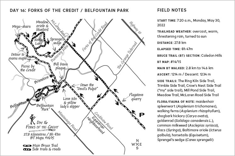
The road led into an open valley, the destination for many years for the Caledon Riding Club’s annual Brimstone Ride on Thanksgiving weekend. We’d ride in, tie up our horses and have lunch. My dad made onion soup and heated it over an open fire in a huge cauldron fashioned by the Trimbles. We had McIntosh apples that taught me the difference between the crisp, freshly picked ones and the mushy stored ones. Dad set up the soup by the river and we played in the tufted grass, rolling like wieners down the steep banks next to where today’s BT passes by an outdoor washroom before heading up the escarpment.
Of all the places I’ve hiked, the Forks of the Credit Park is my favourite. Countless times, I’ve walked next to the washroom, across the sandy cart track, past the wiener hill, alongside the poison ivy, through a soaring maple forest where white trilliums blanket the forest floor in spring, and up the long ascent to the ridgetop. Today, I turned left at the ridgetop and followed the Mill Pond Side Trail. It skirts the valley lip, so you walk almost level with some treetops, then drops down a long set of stairs to the ruins of an old power plant and waterfall, and crosses over where the dam used to be. The Elora Cataract Trailway and the soon-to-be Credit Valley Trail run parallel to the BT before converging in the village of Cataract. At the intersection of two railways (Credit Valley Railway and the Hamilton and North-Western Railway), Cataract was once home to various hotels and bars needed to service those arriving in this transportation hub. Its hills are rich with stories of rushes for gold never found, salt never extracted, Canada Dry water wells and exploding dams. I crossed over the main Credit River and climbed back up the escarpment, then I followed a section of the Trans Canada Trail to the Meadow Trail.
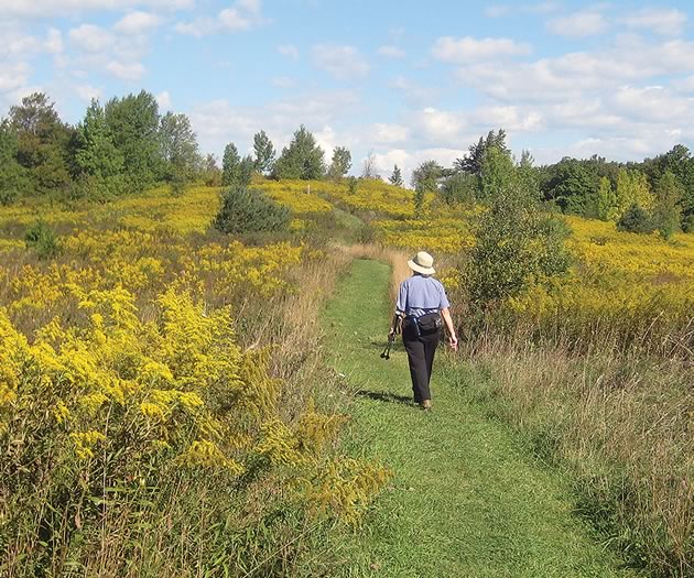
This is my favourite Forks of the Credit Park trail. It dissects what was once pastureland. This hummocky landscape is the western extreme of the Oak Ridges Moraine, for the Niagara Escarpment and the Oak Ridges Moraine collide in the Forks Park. Milkweed and goldenrod, old apple trees, bluebirds, Baltimore orioles, Eastern meadowlarks and other meadow-loving species find refuge in this vast open landscape partly thanks to a team including local naturalist Don Scallen. They keep the surrounding forest at bay. More recently, Ontario Parks took more drastic steps. It has razed the meadow to encourage growth of a rare tall-grass prairie. This effort is music to my meadow-loving ears. There’s a kettle lake where I’ve spied bufflehead ducks and enormous snapping turtles. White-tail deer abound. On this day, purple lilacs added colour to the vibrant green, early-season grasses that swayed in the warm breeze.


I paused at the intersection of the Meadow and Ruins trails, the spot where I dream of building a house. From this perch, the meadow stretched away, showing off under a deep blue sky. Farther down the trail, the orange belly of a Baltimore oriole caught my eye. I returned to the main BT as it returned to the ridgetop overlooking maples that reached to the heavens. Ancient horsetails blanketed the sides of the trail as I climbed over a sandy kame. On the far side, tufted mounds of sedge dotted the forest floor as the trail dropped down to course the ridge at mid-tree level. Then it was up again, reminding me that this was the Caledon Hills section. (This turned out to be my second hilliest hike along the entire trail.) Then down onto Puckering Lane where I’d met Hoffman and her goat that day long ago and where, today, I did my best to ignore the plethora of No Trespassing signs that flank the road. I’m thankful that Ray Lowes was spared the warnings of video surveillance.
. . . .
I love this landscape because of the images it conjures for me of youthful times, but also because I know it so well. I feel secure in Caledon. Being here is like snuggling in bed on a rainy morning. I know the trails, the hills, the trees, its smells and sounds. I fit into this landscape. It’s a connection that has taken decades to develop. My ties have evolved over time. I have neighbours who continue to live where their ancestors built the mills and farmed virgin land. I now realize their connections dwell deeper than mine. And what about the Mississaugas of the Credit who travelled the river of my birthplace. To escape encroachments of the settlers and declining natural resources (things I could relate to), they moved to land adjacent to the Six Nations Reserve near Hamilton in the mid-1800s. In 2010, the Mississaugas of the Credit received $145 million as compensation. It saddens me to think they needed to break 10,000 years of their relationship to the land. What would it feel like to have Caledon that deeply ingrained in me? What would it feel like to be forced to leave?
HIKING THE BRUCE TRAIL END TO END
Loop It, Record It and Reward It!
![]() With its 440 kilometres of side trails, the Bruce Trail offers something that most long-distance routes do not: you can loop your way along it as Nicola did. Her loopy end-to-end offers hikers a way to enjoy the trail without a car or bicycle drop, trail angels or a taxi. Solo hikers can be self-sufficient, carrying only a daypack – albeit a well-stocked daypack for safety’s sake.
With its 440 kilometres of side trails, the Bruce Trail offers something that most long-distance routes do not: you can loop your way along it as Nicola did. Her loopy end-to-end offers hikers a way to enjoy the trail without a car or bicycle drop, trail angels or a taxi. Solo hikers can be self-sufficient, carrying only a daypack – albeit a well-stocked daypack for safety’s sake.
If the idea of completing similar or even the same loops as Nicola did appeals to you, you are in luck. Various Bruce Trail clubs are combining their energies with her to develop a loopy passport/journal and a “Loving the Bruce Trail Loops” badge.
For each of Nicola’s 40-plus loops, the passport/journal will include:
- a map
- step by step directions
- Nicola’s field notes
- space to record your own field notes (and sketches if you feel so inclined)
When accompanied by The Bruce Trail Reference Maps and Trail Guide and, advisedly, the Bruce Trail app, the passport/journal will help hikers record their loop hikes.
Complete all the loops in a participating Bruce Trail club section and you’ll receive the badge. (There are between three and seven loops ranging in length from 12 to 30 kilometres for each of the trail’s nine sections.)
Related Stories
An Audacious Idea – The Bruce Trail Turns 50
“What,” Lowes asked, “would you think of a hiking trail winding up the Niagara Escarpment from one end to the other?”
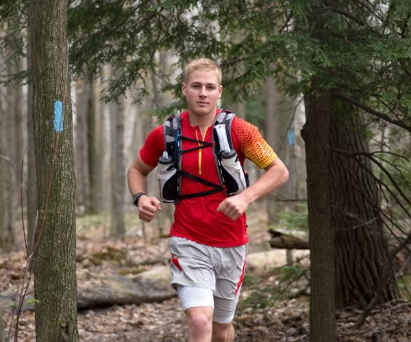
The End to End Challenge: Cody Gillies
Two goals: beat the current 13-day trail record & and raise $25,000 for the pediatrics unit at Headwaters Health Care Centre.
Nature Booster: Janice McClelland
How the Erin resident transformed a passion for the outdoors into many fruitful years of volunteering for the Bruce Trail Conservancy.


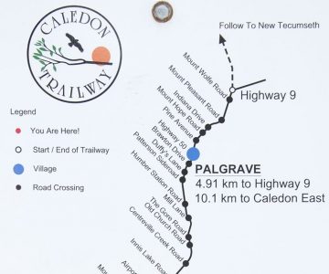
I picked up the latest issue of In The Hills at Spirit Tree the other day and this was the first article I read — largely because I’ve been enjoying those same trails since the 1960s, either on foot or two wheels. As much as the area has changed over the years, the allure of the Forks of the Credit has never waned for me. One hopes, however, that its ever-increasing popularity can be carefully managed so that the area can continue be enjoyed by all without it becoming overrun. (A tall order, to say the least.) The design of the planned Credit Valley Trail and its supporting elements — notably parking, which has been virtually non-existent at the Forks since the pandemic — will be key elements to managing this growth. I look forward to the Region sharing its plans and inviting input in advance of the trail becoming a reality. Speaking of that trail, I should note a small error in the article. Both rail lines that met at Cataract were actually built by the Credit Valley Railway. The CVR wound up in the hands of the Ontario & Quebec Railway, and, in turn, Canadian Pacific, by 1884. The Hamilton & North Western Railway built the line that ran through Georgetown, Cheltenham and Inglewood, where it was crossed by the Credit Valley line. Today, the H&NW route forms the basis of the Caledon Trailway.
Ron Bouwhuis from Brampton (though I prefer to say Snelgrove!) on Mar 27, 2024 at 5:47 pm |